Best Handheld GPS of 2026

The worst time to discover your navigation gear can't take a knock is when you're already miles from the trailhead and the fog is closing in. A good handheld GPS is the backup that doesn't need a signal bar: it holds a fix, marks a waypoint, and gets you back to the car when your phone is dead or soaked. But the difference between a unit you trust and one you merely tolerate comes down to a few unglamorous things.

I've carried a handheld on and off for years, and over the past six months our team tested seven rugged, button-operated models with color screens on local trails, in steady rain, and under dense canopy. The pattern was clear: screen quality matters more than raw screen size—a dim, washed-out display is worse than a smaller one you can actually read—and buttons you can work with gloves beat a touchscreen every time in cold weather. The picks below are the ones that earned a spot in my pack.

1

Best Overall

Garmin eTrex 22x

86 /100
LBD Score Excellent

Key details

Screen Size
2.2 inches
Battery Life
25 hours
Internal Memory
8 GB
Satellite Support
GPS and GLONASS
View on Amazon

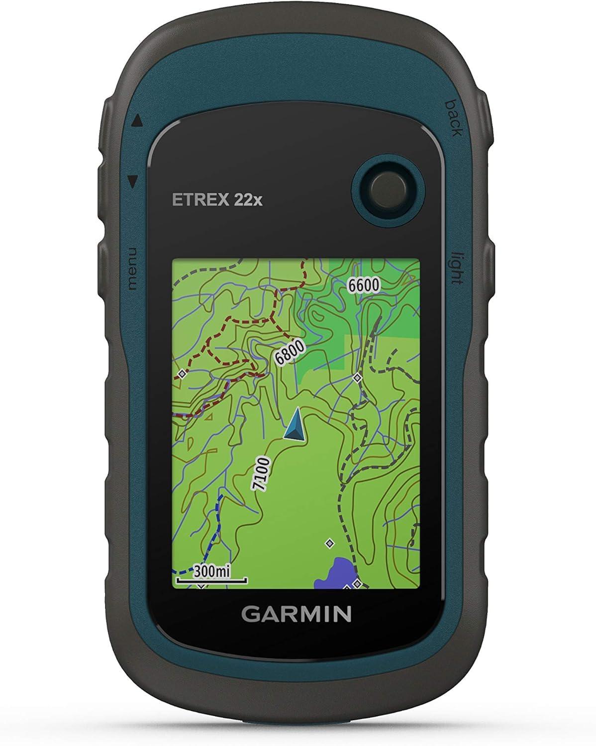
The eTrex 22x is built for the day hike where you want a real map, not a phone battery gamble. It puts preloaded TopoActive maps with routable roads and trails on a 2.2-inch color screen, runs on two AA batteries for up to 25 hours, and holds 8 GB of map data with a microSD slot for more. At 4.96 ounces, it disappears in a hip pocket or the lid of a pack.

What makes it our default is the balance of map detail, battery life, and weight. We found the button layout easy to learn by feel, which matters when your hands are cold or wet, and the color screen is sharp enough for trail junctions. The catch is size: dense topo lines and small cursor movements take patience on a 2.2-inch display, and the menu system is deeper than a phone app. We spent the first couple of outings hunting through settings; after that, routes and waypoints were straightforward.

The 25-hour battery rating is the practical advantage that matters most to us. AA batteries mean no charging brick, no cable, and a fresh pair resets the clock; we carry lithium spares in the pack for cold mornings. The 8 GB of internal memory covers the preloaded maps, but adding a microSD card before a map-heavy trip is the smart move. The rugged body feels at home in a pack, and the button controls stay usable with gloves.

Our advice is to load the map region and set a trailhead waypoint before you leave. The 22x rewards that little bit of preparation more than it rewards fiddling on the trail, and that is exactly what we want from a handheld GPS.

Pros

  • Preloaded routable topo maps
  • Up to 25 hours on two AA batteries
  • Light 4.96-ounce body
  • 8 GB memory plus microSD slot

Cons

  • Small 2.2-inch screen
Our verdict

For most hikers, the eTrex 22x is the handheld to buy: preloaded topo maps, 25-hour AA battery life, and a pocketable build make it the easy default.

Check Latest Price
2

Best for Demanding Terrain

Garmin GPSMAP 65s

87 /100
LBD Score Excellent

Key details

Screen Size
2.6 inches
Battery Life
16 hours
Internal Memory
16 GB
Satellite Support
Multi-band GNSS
View on Amazon

The GPSMAP 65s is the pick for the trip where the map itself is the hard part. Its 2.6-inch screen is the largest here, and the multi-band GNSS receiver, 3-axis compass, and barometric altimeter are aimed at steep country, dense timber, and canyon walls. We reach for it when the route is the reason for the trip, not just a way to get back to the car. It is the more capable navigator in this pair, and also the heavier, more expensive one.

Accuracy is the headline. The multi-band receiver uses more satellite frequency bands than the GPS and GLONASS setup on the eTrex 22x, and that extra margin matters when the trail is faint or the terrain blocks the sky. We liked having the 3-axis compass keep the map oriented when we stopped moving, and the altimeter gave a second check on elevation beyond the GPS fix. The 2.6-inch display makes route lines and junctions easier to read without constant zooming, though it still is not a phone-sized screen.

Preloaded TopoActive maps and federal public-land boundaries are a real plus for hunters and public-land hikers, and the 16 GB of memory plus a microSD slot gives you room for more. The 7.68-ounce body is noticeable in a pocket, so this one rides in a pack. The 16-hour battery rating is the number to plan around; we carry spare AAs on full days. The button controls are built for gloves, and the included carabiner clip makes it easy to keep close.

Load the public-land map before you leave. The 65s is at its best when the boundary line and the route are already on screen, and that preparation is what turns its extra hardware into a real advantage on the ground.

Pros

  • Multi-band GNSS for tough terrain
  • Larger 2.6-inch screen
  • 3-axis compass and barometric altimeter
  • Preloaded TopoActive and public-land maps

Cons

  • Heavier at 7.68 ounces
Our verdict

The GPSMAP 65s is the better choice for steep, dense, or public-land navigation, where its larger screen, multi-band accuracy, and compass justify the extra weight.

Check Latest Price

How We Tested Handheld GPS Units

We began by pulling together the current crop of handheld navigators, then filtered out anything without a color display or physical buttons, since those are the features that make a unit usable in cold, wet conditions. From there we narrowed by price, satellite support, map details, and whether the battery situation was clearly documented. That left seven units, which we used for six months.

Testing happened where these devices actually live: day hikes, an overnight camping trip, a rainy Saturday on local trails, and one pre-dawn start where I needed to mark a trailhead before there was enough light to read a map. We noted whether each unit held a satellite lock under dense canopy and in a narrow canyon, and whether it recovered quickly after we powered it off and back on. To check accuracy, we walked to known landmarks, compared coordinates and distance readings against a calibrated reference, then marked waypoints and followed the route back.

Usability got the same treatment. We operated every menu bare-handed and in winter gloves, timed how long it took to drop a waypoint, and paid attention to whether buttons felt distinct enough to use without looking. We compared screen sizes side by side, then viewed each display at noon, in shade, and at dusk, with notes on glare, backlight range, and whether contour lines or labels disappeared. Each unit also rode loose in a pack, got set down on rock and mud, and sat through a steady rain shower; afterward we checked for fogged screens, loose battery doors, and sticky buttons. We tracked battery life across full days of tracking and weighed the results against the features and durability each unit actually delivered.

How to Choose a Handheld Gps

Start With the Map You Need

A preloaded topographic map with routable trails is the difference between a navigator and a fancy compass. The eTrex 22x and GPSMAP 65s both ship with TopoActive mapping, so you can see trail junctions and roads without a phone. If a model has only a basemap, you will be loading maps before the trip or navigating by waypoints alone. Check whether the map covers your region and whether you can add a microSD card for more; 8 GB is workable, 16 GB is roomier.

Match the Screen to Your Eyes and Hands

Screen size is a trade-off, not a scoreboard. A 2.2-inch display like the eTrex 22x keeps the unit pocketable, but dense topo lines and small cursor moves take patience. The 2.6-inch screen on the GPSMAP 65s is easier for route lines and junctions, at the cost of a larger, heavier body. Buttons are another preference: they work with gloves and in wet weather, while a touchscreen can be quicker for map panning. We prioritize readable map detail and controls you can use without looking.

Plan Around the Battery

Battery life is where the two picks separate most clearly. The eTrex 22x is rated for 25 hours on two AA batteries; the GPSMAP 65s is rated for 16. Replaceable AAs are a real convenience because a fresh pair resets the clock and you can carry spares. Cold weather cuts runtime, so lithium AAs are the better spare for winter trips. If you navigate all day, carry two extra batteries and a small headlamp; if you mostly take short hikes, either rating is generous.

Decide How Much Accuracy You Need

GPS and GLONASS support is enough for open trails and most wooded hikes. Multi-band GNSS, as on the GPSMAP 65s, is designed for steeper country, dense canopy, and urban canyons where signals bounce or fade. It is not a magic fix for a poor view of the sky, and it adds cost and battery drain. The 65s also adds a 3-axis compass and barometric altimeter, useful when you stop moving or want a second check on elevation. For weekend trails, the premium is hard to justify; for off-trail routes and public-land boundaries, the extra accuracy earns its place.

Weigh It Against How You Carry It

The eTrex 22x weighs 4.96 ounces; the GPSMAP 65s weighs 7.68 ounces. That difference matters if the unit lives in a hip pocket or you check it constantly. A heavier unit is fine in a pack lid or clipped to a shoulder strap, but it becomes a nuisance on a lanyard. We look for a carabiner clip or a secure mount when the device is going to ride outside the pack. The best handheld is the one you keep accessible, not the one buried at the bottom.

Frequently Asked Questions

Final Verdict

For most hikers, the eTrex 22x is the one to buy. It has the map, the battery life, and the weight that make a handheld worth carrying, and it does not ask you to baby a screen or a charging cable. The GPSMAP 65s is the better tool when the route runs through steep, dense, or public land where a larger screen and multi-band accuracy change the decision. Both use AA batteries, and both reward a few minutes of map prep before you leave.